Slope and wall stability engineering in Blenheim addresses the critical challenge of securing natural and man-made slopes, retaining walls, and earth structures against failure. The region's unique combination of steep hill country, alluvial plains, and the active Wairau Fault zone creates a landscape where ground movement is not just possible but predictable without proper intervention. For property developers, council infrastructure planners, and vineyard managers across Marlborough, understanding and managing slope stability is fundamental to protecting assets, ensuring public safety, and complying with regulatory requirements. A comprehensive slope stability analysis forms the foundation of any robust geotechnical assessment in this terrain.
Blenheim sits at the confluence of the Wairau and Ōpaoa rivers, with the Richmond Range rising sharply to the west and the Wither Hills defining the southern skyline. The underlying geology is dominated by Quaternary alluvial gravels, silts, and sands in the valley floor, transitioning to Tertiary sedimentary rocks—particularly mudstones, sandstones, and limestones—on the surrounding slopes. These mudstones, part of the East Coast Basin succession, are notoriously susceptible to weathering and strength degradation when exposed to the region's seasonal rainfall patterns. Additionally, loess deposits mantle many hillslopes, and their collapse upon wetting is a well-documented trigger for instability. Liquefaction potential in the alluvial deposits during seismic events adds another layer of complexity that must be integrated into wall and slope design.
All slope and wall works in Blenheim must align with the national framework established by the Building Act 2004 and the Resource Management Act 1991, with technical guidance drawn from the New Zealand Geotechnical Society's guidelines and MBIE's Module 6: Earthquake Geotechnical Engineering. The Marlborough District Council enforces these through its District Plan, which maps known erosion-prone areas and landslide susceptibility zones. For retaining walls exceeding 1.5 metres in height, or any structure surcharging a slope, a producer statement from a Chartered Professional Engineer is typically required. Earthquake loading provisions follow NZS 1170.5, with Blenheim located in a high seismic hazard zone due to its proximity to the plate boundary, making seismic earth pressures and slope deformations critical design considerations.
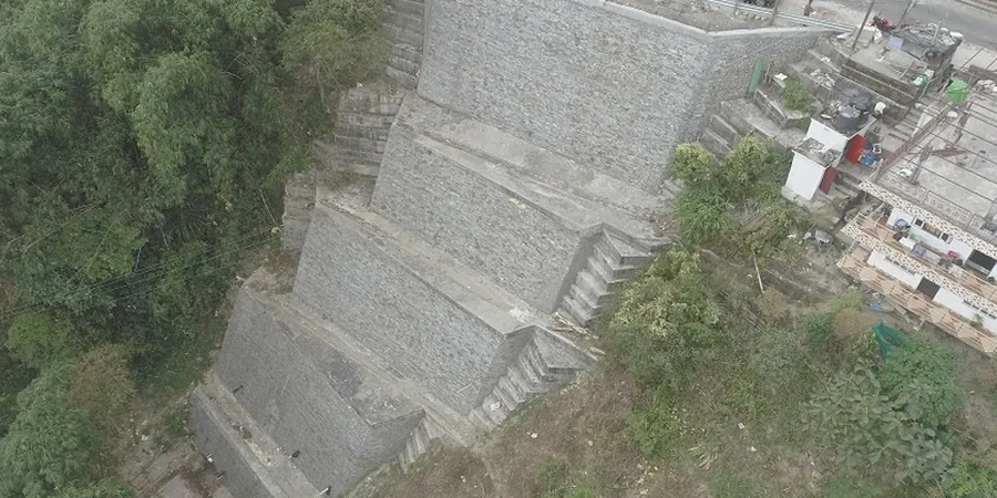
The types of projects requiring slope and wall expertise in Blenheim are diverse. Hillside residential subdivisions on the Wither Heights or Redwood Pass demand cut-and-fill slope stabilisation and engineered retaining solutions to create buildable platforms while managing long-term creep and stormwater runoff. Vineyard terracing on the undulating valley margins requires assessment of slope geometry and drainage to prevent shallow landslides that could damage valuable vines and irrigation infrastructure. State Highway and local road networks, particularly where they traverse the Dashwood or Taylor Pass, rely on rockfall catchment systems and soil-nailed walls to maintain corridor resilience. Even commercial developments on the flat require temporary shoring and basement retention where excavations encounter groundwater within the permeable gravels.
Key indicators include tension cracks in the ground surface, leaning trees or fence posts, bulging at the toe of a slope, and water seepage zones on hillsides. On retaining walls, look for cracking, tilting, or drainage staining. In Blenheim's loess-covered hills, sudden settlement or small collapse features after heavy rain often precede larger failures and warrant immediate engineering assessment.
Under the Building Act, any retaining wall exceeding 1.5 metres in height requires building consent. Additionally, walls supporting a surcharge—such as a driveway, building, or sloping ground above—may need consent regardless of height. The Marlborough District Plan may impose further restrictions in erosion hazard areas, and all walls must comply with the New Zealand Building Code Clause B1 (Structure).
Blenheim's location near the Alpine Fault and Wairau Fault system means earthquake-induced ground shaking can trigger landslides, cause retaining wall rotation, and induce liquefaction in the valley's alluvial soils. Design must incorporate seismic earth pressures per NZS 1170.5, assess slope deformations under design earthquake scenarios, and often require ground improvement or deeper foundation elements to ensure post-event functionality.
Drainage is arguably the most critical factor in long-term slope performance. The Wither Hills' mudstone and loess soils lose significant strength when saturated. Effective subsurface drainage—using horizontal drains, chimney drains behind retaining walls, or surface water cut-off channels—reduces pore water pressures that drive instability. Poorly managed stormwater from upslope development is a leading cause of otherwise preventable failures.